
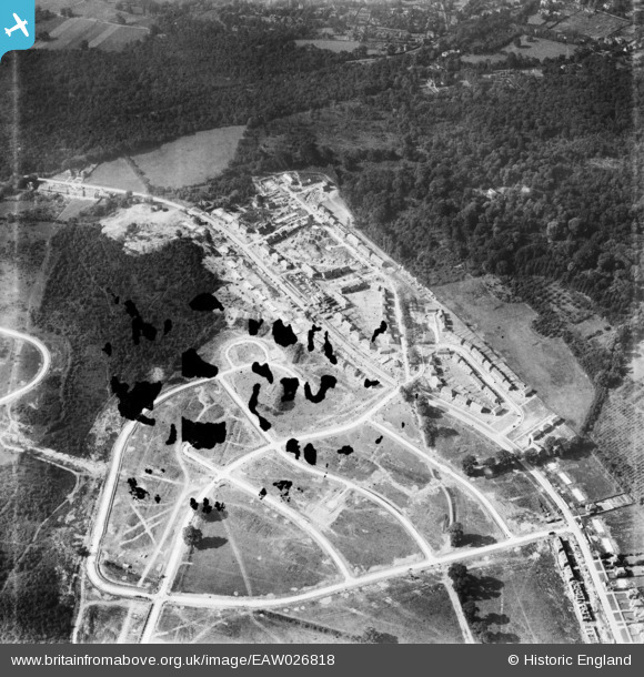
EAW026818 ENGLAND (1949). Housing estate under construction at St Paul's Cray, Bromley, 1949. This image has been produced from a damaged negative.
© Hawlfraint cyfranwyr OpenStreetMap a thrwyddedwyd gan yr OpenStreetMap Foundation. 2026. Trwyddedir y gartograffeg fel CC BY-SA.
Delweddau cyfagos (5)
EAW026818

EAW020728

EPW045552

EAW026819

EAW020729

Manylion
| Pennawd | [EAW026818] Housing estate under construction at St Paul's Cray, Bromley, 1949. This image has been produced from a damaged negative. |
| Cyfeirnod | EAW026818 |
| Dyddiad | 3-October-1949 |
| Dolen | |
| Enw lle | BROMLEY |
| Plwyf | |
| Ardal | |
| Gwlad | ENGLAND |
| Dwyreiniad / Gogleddiad | 545752, 169551 |
| Hydred / Lledred | 0.095771887885713, 51.405736477992 |
| Cyfeirnod Grid Cenedlaethol | TQ458696 |
Pinnau
Byddwch y cyntaf i ychwanegu sylw at y ddelwedd hon!