
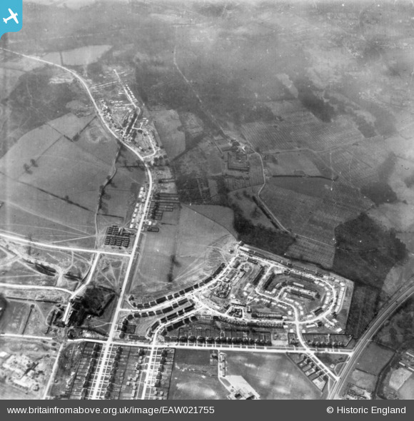
EAW021755 ENGLAND (1949). Housing estate under construction, St Paul's Cray, 1949. This image has been produced from a print.
© Hawlfraint cyfranwyr OpenStreetMap a thrwyddedwyd gan yr OpenStreetMap Foundation. 2026. Trwyddedir y gartograffeg fel CC BY-SA.
Delweddau cyfagos (5)
EAW021755

EAW021756

EPW045613

EAW026812

EAW026813

Manylion
| Pennawd | [EAW021755] Housing estate under construction, St Paul's Cray, 1949. This image has been produced from a print. |
| Cyfeirnod | EAW021755 |
| Dyddiad | 1-April-1949 |
| Dolen | |
| Enw lle | ST PAUL'S CRAY |
| Plwyf | |
| Ardal | |
| Gwlad | ENGLAND |
| Dwyreiniad / Gogleddiad | 546141, 170032 |
| Hydred / Lledred | 0.10155951897388, 51.409958911287 |
| Cyfeirnod Grid Cenedlaethol | TQ461700 |
Pinnau

Matt Aldred edob.mattaldred.com |
Tuesday 8th of April 2025 01:19:12 PM | |

Broom1 |
Tuesday 16th of February 2016 08:57:56 PM |