
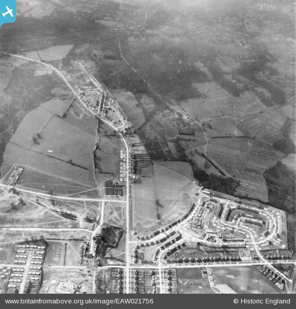
EAW021756 ENGLAND (1949). Housing estate under construction, St Paul's Cray, 1949. This image has been produced from a print.
© Hawlfraint cyfranwyr OpenStreetMap a thrwyddedwyd gan yr OpenStreetMap Foundation. 2026. Trwyddedir y gartograffeg fel CC BY-SA.
Delweddau cyfagos (5)
EAW021756

EPW045613

EAW021755

EAW021757

EPW045614

Manylion
| Pennawd | [EAW021756] Housing estate under construction, St Paul's Cray, 1949. This image has been produced from a print. |
| Cyfeirnod | EAW021756 |
| Dyddiad | 1-April-1949 |
| Dolen | |
| Enw lle | ST PAUL'S CRAY |
| Plwyf | |
| Ardal | |
| Gwlad | ENGLAND |
| Dwyreiniad / Gogleddiad | 546000, 169885 |
| Hydred / Lledred | 0.099472824787117, 51.408674206754 |
| Cyfeirnod Grid Cenedlaethol | TQ460699 |
