
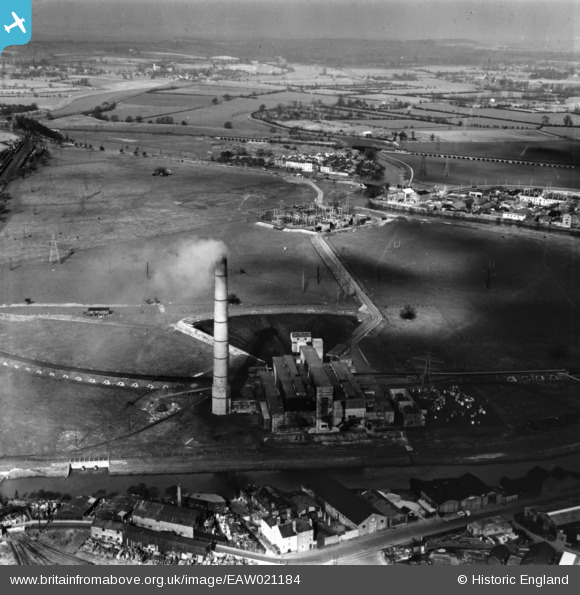
EAW021184 ENGLAND (1949). Castle Meads Power Station and environs, Gloucester, from the south, 1949. This image has been produced from a print.
© Hawlfraint cyfranwyr OpenStreetMap a thrwyddedwyd gan yr OpenStreetMap Foundation. 2026. Trwyddedir y gartograffeg fel CC BY-SA.
Delweddau cyfagos (18)
EAW021184

EAW021181

EAW021185

EAW018728

EAW012210

EAW021182

EAW021183

EAW021187

EPW037837

EPW024157

EAW021189

EAW012209

EPW037749

EAW012202

EAW012200

EPW037834

EPW037750

EAW012197

Manylion
| Pennawd | [EAW021184] Castle Meads Power Station and environs, Gloucester, from the south, 1949. This image has been produced from a print. |
| Cyfeirnod | EAW021184 |
| Dyddiad | 2-March-1949 |
| Dolen | |
| Enw lle | GLOUCESTER |
| Plwyf | |
| Ardal | |
| Gwlad | ENGLAND |
| Dwyreiniad / Gogleddiad | 382437, 218319 |
| Hydred / Lledred | -2.2550772558731, 51.862735156095 |
| Cyfeirnod Grid Cenedlaethol | SO824183 |
Pinnau
Byddwch y cyntaf i ychwanegu sylw at y ddelwedd hon!