
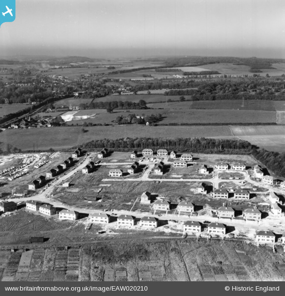
EAW020210 ENGLAND (1948). Housing development surrounding Winding Way, Salisbury, from the east, 1948. This image has been produced from a print.
© Hawlfraint cyfranwyr OpenStreetMap a thrwyddedwyd gan yr OpenStreetMap Foundation. 2026. Trwyddedir y gartograffeg fel CC BY-SA.
Delweddau cyfagos (9)
EAW020210

EAW020212

EAW020211

EAW020213

EAW020209

EAW020216

EAW020217

EAW020215

EAW020214

Manylion
| Pennawd | [EAW020210] Housing development surrounding Winding Way, Salisbury, from the east, 1948. This image has been produced from a print. |
| Cyfeirnod | EAW020210 |
| Dyddiad | 26-October-1948 |
| Dolen | |
| Enw lle | SALISBURY |
| Plwyf | SALISBURY |
| Ardal | |
| Gwlad | ENGLAND |
| Dwyreiniad / Gogleddiad | 412077, 131410 |
| Hydred / Lledred | -1.8275701624811, 51.081350968994 |
| Cyfeirnod Grid Cenedlaethol | SU121314 |
Pinnau

Peter Kirk |
Tuesday 7th of November 2017 11:10:46 AM |