
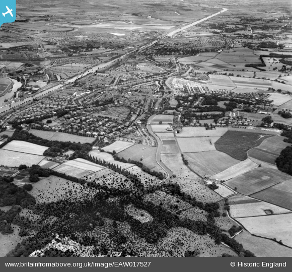
EAW017527 ENGLAND (1948). The residential area surrounding the Bridgewater Canal, Stockton Heath, 1948. This image has been produced from a damaged negative.
© Hawlfraint cyfranwyr OpenStreetMap a thrwyddedwyd gan yr OpenStreetMap Foundation. 2026. Trwyddedir y gartograffeg fel CC BY-SA.
Delweddau cyfagos (3)
EAW017527

EAW017532

EAW017538

Manylion
| Pennawd | [EAW017527] The residential area surrounding the Bridgewater Canal, Stockton Heath, 1948. This image has been produced from a damaged negative. |
| Cyfeirnod | EAW017527 |
| Dyddiad | 22-July-1948 |
| Dolen | |
| Enw lle | STOCKTON HEATH |
| Plwyf | STOCKTON HEATH |
| Ardal | |
| Gwlad | ENGLAND |
| Dwyreiniad / Gogleddiad | 360928, 385527 |
| Hydred / Lledred | -2.5872270488941, 53.364901595426 |
| Cyfeirnod Grid Cenedlaethol | SJ609855 |
Pinnau

TheCreteFleet |
Monday 24th of April 2023 04:01:53 PM | |

Bottom Yard |
Monday 26th of September 2022 04:47:35 PM | |
|
Mike Richardson |
Saturday 1st of March 2014 04:29:04 PM | |
|
Mike Richardson |
Saturday 1st of March 2014 04:28:22 PM |