
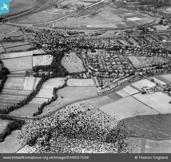
EAW017538 ENGLAND (1948). The residential area between the Manchester Ship Canal and the Bridgewater Canal, Stockton Heath, 1948. This image has been produced from a damaged negative.
© Hawlfraint cyfranwyr OpenStreetMap a thrwyddedwyd gan yr OpenStreetMap Foundation. 2026. Trwyddedir y gartograffeg fel CC BY-SA.
Delweddau cyfagos (2)
EAW017538

EAW017527

Manylion
| Pennawd | [EAW017538] The residential area between the Manchester Ship Canal and the Bridgewater Canal, Stockton Heath, 1948. This image has been produced from a damaged negative. |
| Cyfeirnod | EAW017538 |
| Dyddiad | 22-July-1948 |
| Dolen | |
| Enw lle | STOCKTON HEATH |
| Plwyf | STOCKTON HEATH |
| Ardal | |
| Gwlad | ENGLAND |
| Dwyreiniad / Gogleddiad | 360684, 385549 |
| Hydred / Lledred | -2.5908967351889, 53.365081261559 |
| Cyfeirnod Grid Cenedlaethol | SJ607855 |
Pinnau

TheCreteFleet |
Monday 24th of April 2023 03:57:40 PM | |
|
TheCreteFleet |
Monday 24th of April 2023 03:57:00 PM | |

therealdjk |
Tuesday 23rd of April 2019 01:53:05 PM | |
|
therealdjk |
Tuesday 23rd of April 2019 01:48:48 PM |