
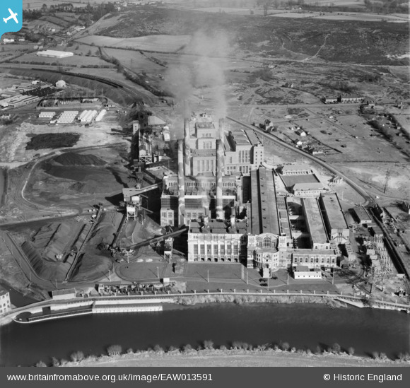
EAW013591 ENGLAND (1948). Stourport Power Station, Stourport-on-Severn, 1948
© Hawlfraint cyfranwyr OpenStreetMap a thrwyddedwyd gan yr OpenStreetMap Foundation. 2026. Trwyddedir y gartograffeg fel CC BY-SA.
Delweddau cyfagos (19)
EAW013591

EAW013586

EAW013587

EAW013583

EPW015080

EAW013588

EAW013589

EAW013593

EAW013592

EAW013582

EAW013584

EPW015081

EPW041764

EPW041763

EAW013590

EAW013581

EAW013585

EAW013580

EAW013579

Manylion
| Pennawd | [EAW013591] Stourport Power Station, Stourport-on-Severn, 1948 |
| Cyfeirnod | EAW013591 |
| Dyddiad | 9-March-1948 |
| Dolen | |
| Enw lle | STOURPORT-ON-SEVERN |
| Plwyf | STOURPORT-ON-SEVERN |
| Ardal | |
| Gwlad | ENGLAND |
| Dwyreiniad / Gogleddiad | 381454, 270760 |
| Hydred / Lledred | -2.2722089344655, 52.33422603891 |
| Cyfeirnod Grid Cenedlaethol | SO815708 |
Pinnau

redmist |
Monday 1st of November 2021 09:06:28 PM | |
|
redmist |
Monday 1st of November 2021 09:05:40 PM | |
|
emu-star |
Sunday 18th of May 2014 05:28:49 PM |