
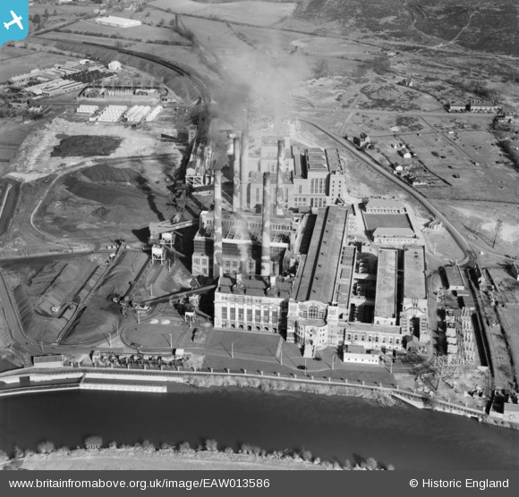
EAW013586 ENGLAND (1948). Stourport Power Station, Stourport-on-Severn, 1948
© Hawlfraint cyfranwyr OpenStreetMap a thrwyddedwyd gan yr OpenStreetMap Foundation. 2026. Trwyddedir y gartograffeg fel CC BY-SA.
Delweddau cyfagos (19)
EAW013586

EAW013591

EAW013587

EAW013583

EPW015080

EAW013592

EAW013588

EAW013593

EAW013582

EAW013589

EPW015081

EPW041764

EAW013584

EPW041763

EAW013585

EAW013590

EAW013581

EAW013580

EAW013579

Manylion
| Pennawd | [EAW013586] Stourport Power Station, Stourport-on-Severn, 1948 |
| Cyfeirnod | EAW013586 |
| Dyddiad | 9-March-1948 |
| Dolen | |
| Enw lle | STOURPORT-ON-SEVERN |
| Plwyf | STOURPORT-ON-SEVERN |
| Ardal | |
| Gwlad | ENGLAND |
| Dwyreiniad / Gogleddiad | 381449, 270746 |
| Hydred / Lledred | -2.2722815480835, 52.334099994021 |
| Cyfeirnod Grid Cenedlaethol | SO814707 |

