
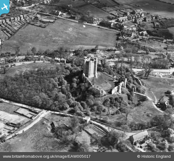
EAW005017 ENGLAND (1947). Conisbrough Castle, Conisbrough, 1947. This image has been produced from a print.
© Hawlfraint cyfranwyr OpenStreetMap a thrwyddedwyd gan yr OpenStreetMap Foundation. 2026. Trwyddedir y gartograffeg fel CC BY-SA.
Delweddau cyfagos (8)
EAW005017

EAW005018

EAW005020

EAW005016

EPW014866

EAW005019

EPW014865

EPW014867

Manylion
| Pennawd | [EAW005017] Conisbrough Castle, Conisbrough, 1947. This image has been produced from a print. |
| Cyfeirnod | EAW005017 |
| Dyddiad | 7-May-1947 |
| Dolen | |
| Enw lle | CONISBROUGH |
| Plwyf | |
| Ardal | |
| Gwlad | ENGLAND |
| Dwyreiniad / Gogleddiad | 451470, 398912 |
| Hydred / Lledred | -1.2242682340683, 53.484154043945 |
| Cyfeirnod Grid Cenedlaethol | SK515989 |
Pinnau

Matt Aldred edob.mattaldred.com |
Wednesday 19th of February 2025 09:27:47 PM | |

redmist |
Thursday 3rd of February 2022 10:48:41 PM | |
|
redmist |
Thursday 3rd of February 2022 10:45:07 PM |