
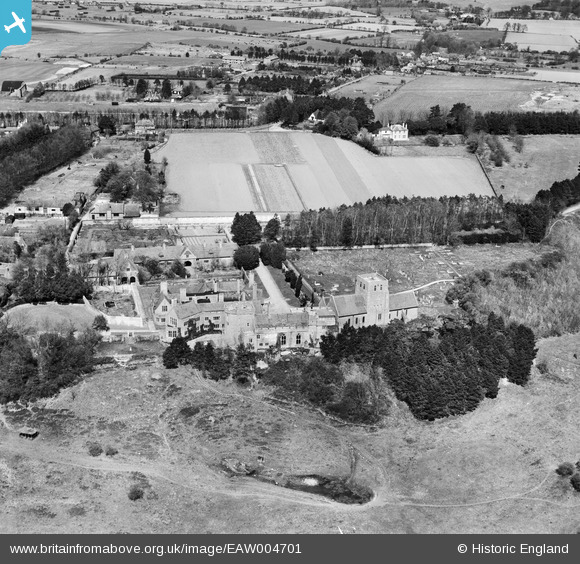
EAW004701 ENGLAND (1947). Lympne Castle, St Stephen's Church and the village, Lympne, 1947
© Hawlfraint cyfranwyr OpenStreetMap a thrwyddedwyd gan yr OpenStreetMap Foundation. 2026. Trwyddedir y gartograffeg fel CC BY-SA.
Delweddau cyfagos (7)
EAW004701

EAW004700

EAW004697

EAW004699

EAW004696

EAW004698

EAW004695

Manylion
| Pennawd | [EAW004701] Lympne Castle, St Stephen's Church and the village, Lympne, 1947 |
| Cyfeirnod | EAW004701 |
| Dyddiad | 26-April-1947 |
| Dolen | |
| Enw lle | LYMPNE |
| Plwyf | LYMPNE |
| Ardal | |
| Gwlad | ENGLAND |
| Dwyreiniad / Gogleddiad | 611952, 134716 |
| Hydred / Lledred | 1.0258396082915, 51.072038145268 |
| Cyfeirnod Grid Cenedlaethol | TR120347 |
Pinnau

Matt Aldred edob.mattaldred.com |
Friday 7th of March 2025 08:35:15 AM | |

totoro |
Friday 25th of October 2013 10:31:30 PM | |
A Roman Road |
totoro |
Friday 25th of October 2013 10:34:09 PM |
|
totoro |
Friday 25th of October 2013 10:23:31 PM | |
|
totoro |
Friday 25th of October 2013 10:21:52 PM |