
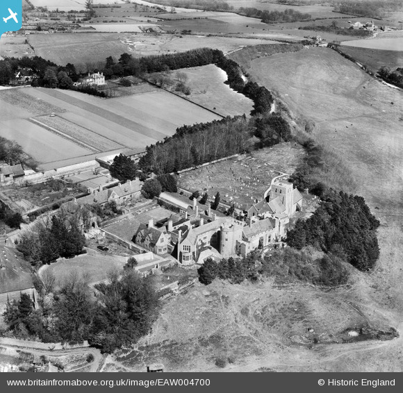
EAW004700 ENGLAND (1947). Lympne Castle, St Stephen's Church and the surrounding countryside, Lympne, 1947
© Hawlfraint cyfranwyr OpenStreetMap a thrwyddedwyd gan yr OpenStreetMap Foundation. 2026. Trwyddedir y gartograffeg fel CC BY-SA.
Delweddau cyfagos (7)
EAW004700

EAW004701

EAW004699

EAW004697

EAW004698

EAW004696

EAW004695

Manylion
| Pennawd | [EAW004700] Lympne Castle, St Stephen's Church and the surrounding countryside, Lympne, 1947 |
| Cyfeirnod | EAW004700 |
| Dyddiad | 26-April-1947 |
| Dolen | |
| Enw lle | LYMPNE |
| Plwyf | LYMPNE |
| Ardal | |
| Gwlad | ENGLAND |
| Dwyreiniad / Gogleddiad | 611962, 134706 |
| Hydred / Lledred | 1.0259762936644, 51.07194464605 |
| Cyfeirnod Grid Cenedlaethol | TR120347 |
Pinnau

Matt Aldred edob.mattaldred.com |
Friday 7th of March 2025 08:45:28 AM | |

totoro |
Friday 25th of October 2013 11:04:48 PM | |
|
totoro |
Friday 25th of October 2013 11:04:33 PM |