
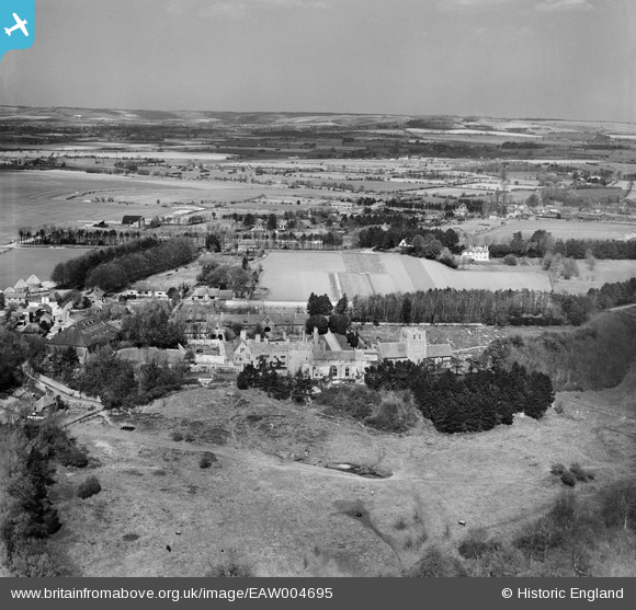
EAW004695 ENGLAND (1947). Lympne Castle, St Stephen's Church and the surrounding countryside, Lympne, from the south, 1947
© Hawlfraint cyfranwyr OpenStreetMap a thrwyddedwyd gan yr OpenStreetMap Foundation. 2026. Trwyddedir y gartograffeg fel CC BY-SA.
Delweddau cyfagos (7)
EAW004695

EAW004698

EAW004697

EAW004699

EAW004696

EAW004700

EAW004701

Manylion
| Pennawd | [EAW004695] Lympne Castle, St Stephen's Church and the surrounding countryside, Lympne, from the south, 1947 |
| Cyfeirnod | EAW004695 |
| Dyddiad | 26-April-1947 |
| Dolen | |
| Enw lle | LYMPNE |
| Plwyf | LYMPNE |
| Ardal | |
| Gwlad | ENGLAND |
| Dwyreiniad / Gogleddiad | 611927, 134609 |
| Hydred / Lledred | 1.0254205271769, 51.071086451031 |
| Cyfeirnod Grid Cenedlaethol | TR119346 |
Pinnau

totoro |
Friday 25th of October 2013 10:48:38 PM | |
|
totoro |
Friday 25th of October 2013 10:46:06 PM | |
At Stanford |
totoro |
Friday 25th of October 2013 10:47:44 PM |
|
totoro |
Friday 25th of October 2013 10:44:21 PM | |
|
totoro |
Friday 25th of October 2013 10:44:03 PM | |
|
totoro |
Friday 25th of October 2013 10:43:46 PM | |
|
totoro |
Friday 25th of October 2013 10:41:56 PM |