
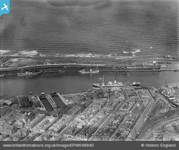
EPW048840 ENGLAND (1935). York Street, the harbour, the North Side Staiths and environs, Blyth, 1935
© Copyright OpenStreetMap contributors and licensed by the OpenStreetMap Foundation. 2026. Cartography is licensed as CC BY-SA.
Nearby Images (21)
EPW048840

EAW013073

EPW048842

EAW013074

EAW014452

EAW014446

EPW048830

EAW013075

EAW013072

EAW014447

EPW048827

EAW014454

EAW014453

EAW014456

EAW013063

EAW013071

EAW013064

EAW014449

EAW014455

EAW014445

EPW048841

Details
| Title | [EPW048840] York Street, the harbour, the North Side Staiths and environs, Blyth, 1935 |
| Reference | EPW048840 |
| Date | August-1935 |
| Link | |
| Place name | BLYTH |
| Parish | EAST BEDLINGTON |
| District | |
| Country | ENGLAND |
| Easting / Northing | 431537, 582085 |
| Longitude / Latitude | -1.5053159313721, 55.13207188786 |
| National Grid Reference | NZ315821 |
Pins
Be the first to add a comment to this image!