
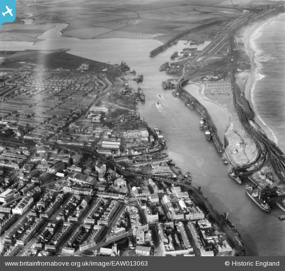
EAW013063 ENGLAND (1948). The Port of Blyth and the town, Blyth, 1948
© Copyright OpenStreetMap contributors and licensed by the OpenStreetMap Foundation. 2026. Cartography is licensed as CC BY-SA.
Nearby Images (26)
EAW013063

EAW013064

EAW014446

EAW013074

EAW014455

EAW014445

EAW014456

EAW014453

EAW014454

EAW014447

EAW013068

EPW019752

EAW014451

EAW013066

EAW014449

EAW014458

EAW013070

EPW048840

EPW048830

EAW014450

EAW014452

EPW019748

EAW014448

EAW013073

EPW019747

EAW013069

Details
| Title | [EAW013063] The Port of Blyth and the town, Blyth, 1948 |
| Reference | EAW013063 |
| Date | 3-February-1948 |
| Link | |
| Place name | BLYTH |
| Parish | BLYTH |
| District | |
| Country | ENGLAND |
| Easting / Northing | 431343, 581966 |
| Longitude / Latitude | -1.5083719981039, 55.13101478377 |
| National Grid Reference | NZ313820 |
Pins

redmist |
Wednesday 6th of November 2019 09:12:03 PM | |
|
redmist |
Wednesday 6th of November 2019 09:11:34 PM | |
|
redmist |
Wednesday 6th of November 2019 09:10:53 PM | |
|
pursebearer |
Friday 7th of February 2014 02:48:04 PM | |
|
pursebearer |
Friday 7th of February 2014 02:44:45 PM | |
|
pursebearer |
Friday 7th of February 2014 02:43:48 PM | |
|
pursebearer |
Friday 7th of February 2014 02:30:23 PM | |
|
pursebearer |
Friday 7th of February 2014 02:25:29 PM |