
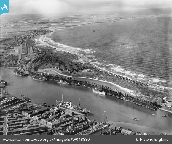
EPW048830 ENGLAND (1935). The harbour, North Blyth, North Beach and environs, Blyth, from the south-west, 1935
© Copyright OpenStreetMap contributors and licensed by the OpenStreetMap Foundation. 2026. Cartography is licensed as CC BY-SA.
Nearby Images (19)
EPW048830

EAW013072

EPW048827

EAW013071

EPW048841

EAW014458

EAW014451

EAW014456

EAW013070

EPW048840

EAW013074

EAW013068

EAW013064

EAW013069

EAW014446

EAW013063

EAW013066

EAW013073

EPW019752

Details
| Title | [EPW048830] The harbour, North Blyth, North Beach and environs, Blyth, from the south-west, 1935 |
| Reference | EPW048830 |
| Date | August-1935 |
| Link | |
| Place name | BLYTH |
| Parish | EAST BEDLINGTON |
| District | |
| Country | ENGLAND |
| Easting / Northing | 431393, 582202 |
| Longitude / Latitude | -1.5075616563801, 55.133132477063 |
| National Grid Reference | NZ314822 |
Pins
Be the first to add a comment to this image!