
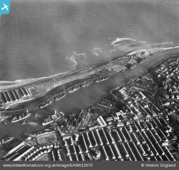
EAW013073 ENGLAND (1948). The Port of Blyth, North Blyth, 1948
© Copyright OpenStreetMap contributors and licensed by the OpenStreetMap Foundation. 2026. Cartography is licensed as CC BY-SA.
Nearby Images (17)
EAW013073

EPW048840

EPW048842

EAW014452

EAW013075

EAW014446

EAW014447

EAW013074

EAW014454

EAW014453

EAW014450

EAW014449

EPW048830

EAW013063

EAW013072

EPW048827

EAW013071

Details
| Title | [EAW013073] The Port of Blyth, North Blyth, 1948 |
| Reference | EAW013073 |
| Date | 3-February-1948 |
| Link | |
| Place name | NORTH BLYTH |
| Parish | EAST BEDLINGTON |
| District | |
| Country | ENGLAND |
| Easting / Northing | 431585, 582047 |
| Longitude / Latitude | -1.5045672715647, 55.131727335629 |
| National Grid Reference | NZ316820 |
