
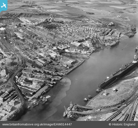
EAW014447 ENGLAND (1948). Blyth Harbour and the town, Blyth, 1948
© Copyright OpenStreetMap contributors and licensed by the OpenStreetMap Foundation. 2026. Cartography is licensed as CC BY-SA.
Nearby Images (26)
EAW014447

EAW014454

EAW014453

EAW014449

EAW014446

EAW013063

EAW014450

EAW013074

EAW014455

EAW014452

EAW014445

EAW013064

EAW013075

EPW019747

EAW014456

EAW013073

EPW048840

EPW048842

EAW013068

EPW019752

EAW014451

EPW019748

EAW014458

EAW013065

EAW014457

EAW013070

Details
| Title | [EAW014447] Blyth Harbour and the town, Blyth, 1948 |
| Reference | EAW014447 |
| Date | 15-April-1948 |
| Link | |
| Place name | BLYTH |
| Parish | BLYTH |
| District | |
| Country | ENGLAND |
| Easting / Northing | 431445, 581902 |
| Longitude / Latitude | -1.5067792416555, 55.130433171636 |
| National Grid Reference | NZ314819 |
Pins

redmist |
Monday 4th of November 2019 11:31:49 PM | |
|
redmist |
Monday 4th of November 2019 11:16:11 PM | |
|
pursebearer |
Thursday 5th of March 2015 06:05:28 PM | |
|
pursebearer |
Thursday 5th of March 2015 06:04:21 PM |