
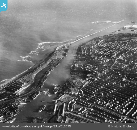
EAW013075 ENGLAND (1948). The Port of Blyth and East Pier, Blyth, 1948
© Copyright OpenStreetMap contributors and licensed by the OpenStreetMap Foundation. 2026. Cartography is licensed as CC BY-SA.
Nearby Images (15)
EAW013075

EAW014452

EPW048842

EAW014450

EAW013073

EAW014449

EAW014447

EAW014454

EPW048840

EPW019747

EAW014453

EAW014457

EAW013065

EAW014446

EAW013074

Details
| Title | [EAW013075] The Port of Blyth and East Pier, Blyth, 1948 |
| Reference | EAW013075 |
| Date | 3-February-1948 |
| Link | |
| Place name | BLYTH |
| Parish | BLYTH |
| District | |
| Country | ENGLAND |
| Easting / Northing | 431610, 581909 |
| Longitude / Latitude | -1.5041905138502, 55.130485578051 |
| National Grid Reference | NZ316819 |
Pins

redmist |
Wednesday 6th of November 2019 10:59:36 PM | |
|
redmist |
Monday 4th of November 2019 11:07:12 PM | |
|
redmist |
Monday 4th of November 2019 11:05:01 PM | |
|
redmist |
Monday 4th of November 2019 11:03:06 PM | |
|
redmist |
Monday 4th of November 2019 11:02:45 PM |