
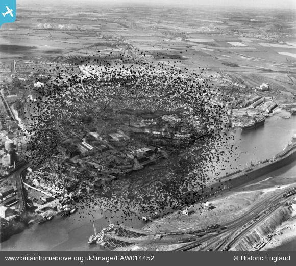
EAW014452 ENGLAND (1948). Blyth Harbour and environs, Blyth, from the east, 1948. This image has been produced from a damaged negative.
© Copyright OpenStreetMap contributors and licensed by the OpenStreetMap Foundation. 2026. Cartography is licensed as CC BY-SA.
Nearby Images (16)
EAW014452

EAW013075

EPW048842

EAW014450

EAW013073

EAW014449

EAW014447

EAW014454

EAW014453

EPW048840

EAW014446

EPW019747

EAW013074

EAW014457

EAW013065

EAW013063

Details
| Title | [EAW014452] Blyth Harbour and environs, Blyth, from the east, 1948. This image has been produced from a damaged negative. |
| Reference | EAW014452 |
| Date | 15-April-1948 |
| Link | |
| Place name | BLYTH |
| Parish | BLYTH |
| District | |
| Country | ENGLAND |
| Easting / Northing | 431584, 581918 |
| Longitude / Latitude | -1.504597310869, 55.13056811652 |
| National Grid Reference | NZ316819 |
Pins

redmist |
Monday 4th of November 2019 11:30:52 PM | |
|
Chris Kolonko |
Wednesday 12th of September 2018 05:37:21 PM |