
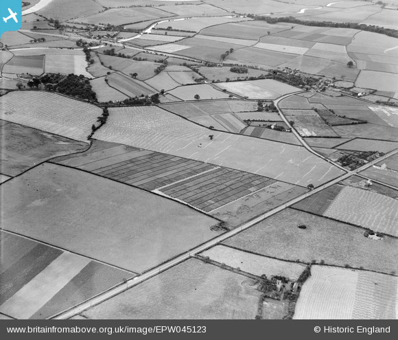
EPW045123 ENGLAND (1934). Trial plots and fieldsto the south of Runcorn Road, Little Leigh, 1934
© Copyright OpenStreetMap contributors and licensed by the OpenStreetMap Foundation. 2026. Cartography is licensed as CC BY-SA.
Nearby Images (18)
EPW045123

EPW045120

EAW030029

EPW045125

EAW030030

EAW030031

EPW045121

EPW045124

EAW030028

EPW032585

EPW045122

EAW030019

EAW030020

EPW032589

EAW030035

EAW030032

EAW030033

EAW030034

Details
| Title | [EPW045123] Trial plots and fieldsto the south of Runcorn Road, Little Leigh, 1934 |
| Reference | EPW045123 |
| Date | July-1934 |
| Link | |
| Place name | LITTLE LEIGH |
| Parish | LITTLE LEIGH |
| District | |
| Country | ENGLAND |
| Easting / Northing | 361239, 376653 |
| Longitude / Latitude | -2.5814676403406, 53.285153790682 |
| National Grid Reference | SJ612767 |
Pins

Bottom Yard |
Monday 3rd of December 2018 04:58:07 PM | |
|
Bottom Yard |
Monday 3rd of December 2018 04:56:54 PM | |
|
Bottom Yard |
Sunday 2nd of December 2018 07:41:29 PM | |
|
Bottom Yard |
Sunday 2nd of December 2018 07:40:16 PM | |
|
Bottom Yard |
Sunday 2nd of December 2018 07:37:28 PM | |
|
Bottom Yard |
Sunday 2nd of December 2018 07:15:01 PM | |
|
Bottom Yard |
Sunday 2nd of December 2018 05:19:56 PM | |
|
Bottom Yard |
Sunday 2nd of December 2018 05:11:10 PM |