
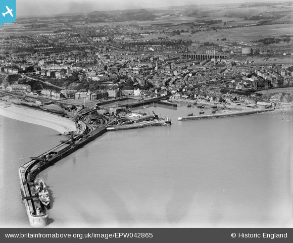
EPW042865 ENGLAND (1933). The Harbour Pier, Inner and Outer Harbours and the town, Folkestone, 1933
© Copyright OpenStreetMap contributors and licensed by the OpenStreetMap Foundation. 2026. Cartography is licensed as CC BY-SA.
Nearby Images (12)
EPW042865

EAW024826

EAW006157

EAW317182

EPW000149

EPW042866

EPW035410

EPW000372

EAW002849

EAW002850

EAW002378

EAW002848

Details
| Title | [EPW042865] The Harbour Pier, Inner and Outer Harbours and the town, Folkestone, 1933 |
| Reference | EPW042865 |
| Date | August-1933 |
| Link | |
| Place name | FOLKESTONE |
| Parish | FOLKESTONE |
| District | |
| Country | ENGLAND |
| Easting / Northing | 623492, 135896 |
| Longitude / Latitude | 1.1910483356056, 51.07825630651 |
| National Grid Reference | TR235359 |
Pins

Sara |
Saturday 4th of August 2018 09:04:13 AM | |
|
Sara |
Saturday 4th of August 2018 09:02:29 AM | |
|
Sara |
Saturday 4th of August 2018 09:01:22 AM | |
|
Sara |
Saturday 4th of August 2018 09:00:27 AM | |
|
Sara |
Saturday 4th of August 2018 08:58:51 AM |