
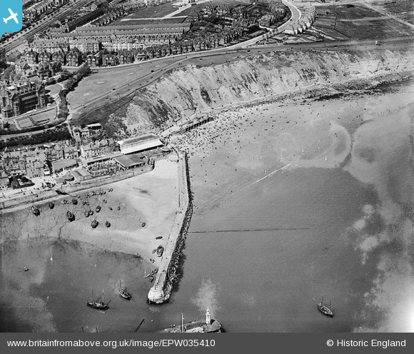
EPW035410 ENGLAND (1931). The Harbour Lighthouse, the Outer Harbour and East Cliff, Folkestone, 1931
© Copyright OpenStreetMap contributors and licensed by the OpenStreetMap Foundation. 2026. Cartography is licensed as CC BY-SA.
Nearby Images (7)
EPW035410

EAW002378

EAW006157

EPW000149

EAW024826

EPW042865

EAW317182

Details
| Title | [EPW035410] The Harbour Lighthouse, the Outer Harbour and East Cliff, Folkestone, 1931 |
| Reference | EPW035410 |
| Date | 25-May-1931 |
| Link | |
| Place name | FOLKESTONE |
| Parish | FOLKESTONE |
| District | |
| Country | ENGLAND |
| Easting / Northing | 623563, 136098 |
| Longitude / Latitude | 1.1921853396597, 51.080042445007 |
| National Grid Reference | TR236361 |
Pins

Sara |
Saturday 4th of August 2018 08:35:00 AM |