
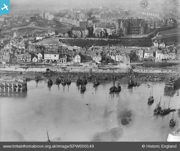
EPW000149 ENGLAND (1920). Outer Harbour and Fish Market, Folkestone, 1920
© Copyright OpenStreetMap contributors and licensed by the OpenStreetMap Foundation. 2026. Cartography is licensed as CC BY-SA.
Nearby Images (10)
EPW000149

EAW006157

EAW024826

EAW317182

EPW035410

EPW000591

EPW000372

EPW042865

EAW002378

EPW019065

Details
| Title | [EPW000149] Outer Harbour and Fish Market, Folkestone, 1920 |
| Reference | EPW000149 |
| Date | February-1920 |
| Link | |
| Place name | FOLKESTONE |
| Parish | FOLKESTONE |
| District | |
| Country | ENGLAND |
| Easting / Northing | 623389, 136067 |
| Longitude / Latitude | 1.1896858124788, 51.079831858051 |
| National Grid Reference | TR234361 |
Pins

Sara |
Sunday 12th of August 2018 03:17:40 PM | |
|
Dol7 |
Monday 10th of April 2017 10:07:42 AM | |
|
Dol7 |
Monday 10th of April 2017 09:35:05 AM | |
|
Dol7 |
Monday 10th of April 2017 09:25:11 AM | |
|
eavyumble |
Sunday 23rd of December 2012 04:21:05 PM | |
|
eavyumble |
Sunday 23rd of December 2012 04:18:06 PM | |
|
eavyumble |
Sunday 23rd of December 2012 04:15:05 PM |