
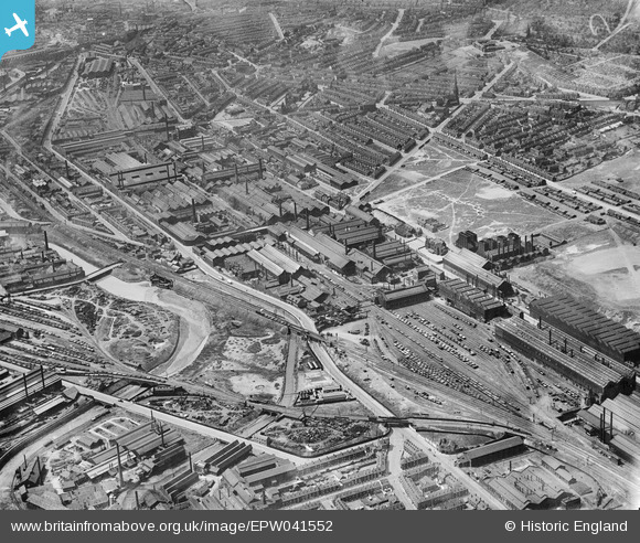
EPW041552 ENGLAND (1933). The Atlas & Norfolk Steel Works and environs, Grimesthorpe, 1933
© Copyright OpenStreetMap contributors and licensed by the OpenStreetMap Foundation. 2026. Cartography is licensed as CC BY-SA.
Nearby Images (17)
EPW041552

EPW041551

EPW007795

EPW041548

EAW009650

EPW041550

EPW041549

EAW009644

EAW009659

EAW009654

EPW041547

EAW018768

EAW018765

EPW041546

EAW009643

EAW018767

EAW009648

Details
| Title | [EPW041552] The Atlas & Norfolk Steel Works and environs, Grimesthorpe, 1933 |
| Reference | EPW041552 |
| Date | June-1933 |
| Link | |
| Place name | GRIMESTHORPE |
| Parish | |
| District | |
| Country | ENGLAND |
| Easting / Northing | 437083, 389098 |
| Longitude / Latitude | -1.4422454227393, 53.397145392648 |
| National Grid Reference | SK371891 |
Pins

Class31 |
Tuesday 21st of July 2015 10:09:55 AM | |

circloy |
Friday 13th of September 2013 12:00:02 AM | |
|
circloy |
Thursday 12th of September 2013 11:55:23 PM | |
|
circloy |
Thursday 12th of September 2013 11:55:01 PM | |
|
circloy |
Thursday 12th of September 2013 11:53:27 PM | |
|
circloy |
Thursday 12th of September 2013 11:49:28 PM | |
|
circloy |
Thursday 12th of September 2013 11:49:05 PM | |
|
circloy |
Thursday 12th of September 2013 11:48:17 PM | |
|
circloy |
Thursday 12th of September 2013 11:47:46 PM |