
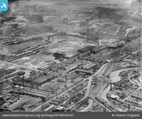
EPW041547 ENGLAND (1933). The Atlas & Norfolk Steel Works and environs, Grimesthorpe, 1933
© Copyright OpenStreetMap contributors and licensed by the OpenStreetMap Foundation. 2026. Cartography is licensed as CC BY-SA.
Nearby Images (27)
EPW041547

EAW018768

EAW018765

EAW018767

EPW041546

EAW018770

EAW009654

EAW020112

EAW020106

EAW018769

EAW018766

EAW020107

EAW018800

EAW020105

EAW018764

EPW041548

EAW009650

EAW020111

EAW020110

EAW020109

EAW018801

EPW007795

EPW041552

EPW041551

EPW041550

EAW020104

EAW020108

Details
| Title | [EPW041547] The Atlas & Norfolk Steel Works and environs, Grimesthorpe, 1933 |
| Reference | EPW041547 |
| Date | June-1933 |
| Link | |
| Place name | GRIMESTHORPE |
| Parish | |
| District | |
| Country | ENGLAND |
| Easting / Northing | 437083, 389288 |
| Longitude / Latitude | -1.4422230892532, 53.398853338594 |
| National Grid Reference | SK371893 |
Pins

Class31 |
Tuesday 21st of July 2015 10:12:41 AM | |
|
Class31 |
Tuesday 21st of July 2015 10:08:09 AM | |
|
Class31 |
Tuesday 21st of July 2015 10:05:22 AM | |

circloy |
Sunday 12th of October 2014 07:37:58 PM | |
2016 aerial footage in film "Wincobank - An Emerald Sanctuary" https://www.youtube.com/watch?v=nUxKc6rxINY |
History Hunter |
Monday 19th of September 2016 09:19:18 PM |