
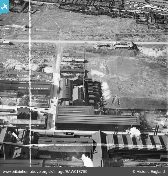
EAW018769 ENGLAND (1948). The Firth-Vickers Stainless Steels Ltd Atlas Works on Carlisle Street East, Grimesthorpe, 1948. This image was marked by Aerofilms Ltd for photo editing.
© Copyright OpenStreetMap contributors and licensed by the OpenStreetMap Foundation. 2026. Cartography is licensed as CC BY-SA.
Nearby Images (23)
EAW018769

EAW020105

EAW018766

EAW018770

EAW020111

EAW018764

EAW018800

EAW018765

EAW020106

EAW018767

EAW020110

EAW018768

EAW020107

EPW041547

EAW020112

EAW018801

EPW041546

EAW020104

EAW020108

EAW020109

EAW009654

EPW041548

EAW009650

Details
| Title | [EAW018769] The Firth-Vickers Stainless Steels Ltd Atlas Works on Carlisle Street East, Grimesthorpe, 1948. This image was marked by Aerofilms Ltd for photo editing. |
| Reference | EAW018769 |
| Date | 21-September-1948 |
| Link | |
| Place name | GRIMESTHORPE |
| Parish | |
| District | |
| Country | ENGLAND |
| Easting / Northing | 437026, 389370 |
| Longitude / Latitude | -1.4430707749281, 53.399594453567 |
| National Grid Reference | SK370894 |
