
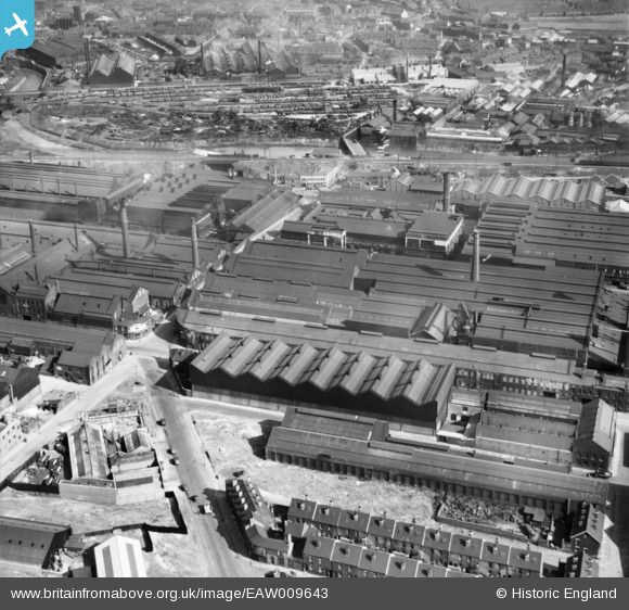
EAW009643 ENGLAND (1947). The Atlas and Norfolk Steel Works, Sheffield, 1947
© Copyright OpenStreetMap contributors and licensed by the OpenStreetMap Foundation. 2026. Cartography is licensed as CC BY-SA.
Nearby Images (17)
EAW009643

EPW041549

EAW009659

EAW009648

EAW009644

EAW009649

EAW009657

EPW041552

EAW009647

EPW041551

EPW041548

EAW009656

EAW009640

EAW009652

EAW009641

EPW007795

EAW009650

Details
| Title | [EAW009643] The Atlas and Norfolk Steel Works, Sheffield, 1947 |
| Reference | EAW009643 |
| Date | 1-September-1947 |
| Link | |
| Place name | SHEFFIELD |
| Parish | |
| District | |
| Country | ENGLAND |
| Easting / Northing | 436889, 388987 |
| Longitude / Latitude | -1.4451761478054, 53.396161185073 |
| National Grid Reference | SK369890 |
Pins

cptpies |
Wednesday 13th of May 2020 04:18:52 PM | |
|
cptpies |
Monday 16th of October 2017 08:03:39 AM | |

Class31 |
Monday 27th of July 2015 11:20:31 AM | |
|
Class31 |
Monday 27th of July 2015 11:19:48 AM | |
|
Class31 |
Monday 27th of July 2015 11:19:27 AM |