
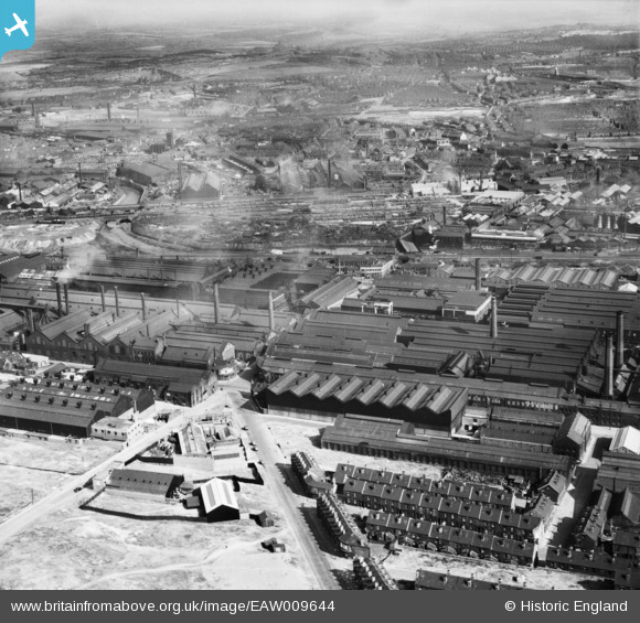
EAW009644 ENGLAND (1947). The Atlas and Norfolk Steel Works, Sheffield, 1947
© Copyright OpenStreetMap contributors and licensed by the OpenStreetMap Foundation. 2026. Cartography is licensed as CC BY-SA.
Nearby Images (15)
EAW009644

EAW009659

EPW041549

EAW009643

EPW041551

EAW009656

EPW041552

EAW009657

EAW009649

EPW007795

EPW041548

EAW009648

EPW041550

EAW009650

EAW009647

Details
| Title | [EAW009644] The Atlas and Norfolk Steel Works, Sheffield, 1947 |
| Reference | EAW009644 |
| Date | 1-September-1947 |
| Link | |
| Place name | SHEFFIELD |
| Parish | |
| District | |
| Country | ENGLAND |
| Easting / Northing | 437032, 388955 |
| Longitude / Latitude | -1.4430292433371, 53.395863518464 |
| National Grid Reference | SK370890 |

