
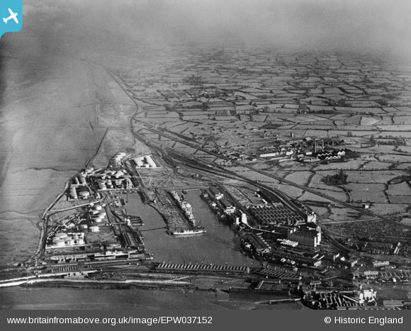
EPW037152 ENGLAND (1931). Avonmouth Docks, Avonmouth, from the south-west, 1931. This image has been produced from a copy-negative.
© Copyright OpenStreetMap contributors and licensed by the OpenStreetMap Foundation. 2026. Cartography is licensed as CC BY-SA.
Nearby Images (23)
EPW037152

EPW027952

EPW005500

EPW005518

EPR000075

EAW002070

EAW002256

EPW005533

EPW005493

EPW044777

EPW005502

EAW002255

EPW005492

EAW002056

EAW002058

EPW005508

EPR000059A

EPW027949

EPW005537

EPW044778

EPW044780

EPW014697

EPW044776

Details
| Title | [EPW037152] Avonmouth Docks, Avonmouth, from the south-west, 1931. This image has been produced from a copy-negative. |
| Reference | EPW037152 |
| Date | October-1931 |
| Link | |
| Place name | AVONMOUTH |
| Parish | |
| District | |
| Country | ENGLAND |
| Easting / Northing | 351098, 178778 |
| Longitude / Latitude | -2.7046643058069, 51.505333650849 |
| National Grid Reference | ST511788 |
Pins
Be the first to add a comment to this image!