
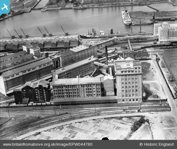
EPW044780 ENGLAND (1934). Co-operative Wholesale Society Flour Mill and other buildings at the Royal Edward Dock, Avonmouth, 1934
© Copyright OpenStreetMap contributors and licensed by the OpenStreetMap Foundation. 2026. Cartography is licensed as CC BY-SA.
Nearby Images (21)
EPW044780

EPW014697

EPW044776

EPW044778

EPW044775

EPW005537

EPW044777

EPW019269

EPW044779

EPW008648

EPW044781

EPW005533

EPW005518

EAW002243

EAW002070

EPW019268

EPW005530

EAW002256

EPW005529

EPW037152

EPW027950

Details
| Title | [EPW044780] Co-operative Wholesale Society Flour Mill and other buildings at the Royal Edward Dock, Avonmouth, 1934 |
| Reference | EPW044780 |
| Date | June-1934 |
| Link | |
| Place name | AVONMOUTH |
| Parish | |
| District | |
| Country | ENGLAND |
| Easting / Northing | 351299, 178583 |
| Longitude / Latitude | -2.7017412514105, 51.503597607315 |
| National Grid Reference | ST513786 |
Pins

Class31 |
Saturday 22nd of February 2014 08:07:39 PM |