
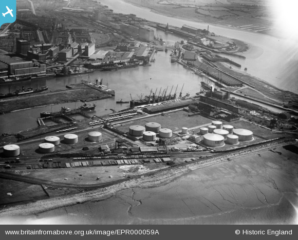
EPR000059A ENGLAND (1934). Royal Edward Dock, Avonmouth, 1934. This image has been affected by flare.
© Copyright OpenStreetMap contributors and licensed by the OpenStreetMap Foundation. 2026. Cartography is licensed as CC BY-SA.
Nearby Images (18)
EPR000059A

EAW002255

EPW005493

EPR000075

EPW005500

EPW005508

EPW005492

EPW005491

EAW002249

EAW002058

EPW005502

EPW027952

EPW005494

EAW002059

EAW002060

EPW005497

EPW037152

EAW002247

Details
| Title | [EPR000059A] Royal Edward Dock, Avonmouth, 1934. This image has been affected by flare. |
| Reference | EPR000059A |
| Date | 4-July-1934 |
| Link | |
| Place name | AVONMOUTH |
| Parish | |
| District | |
| Country | ENGLAND |
| Easting / Northing | 350898, 178919 |
| Longitude / Latitude | -2.7075656521045, 51.506584149346 |
| National Grid Reference | ST509789 |
Pins
Be the first to add a comment to this image!