
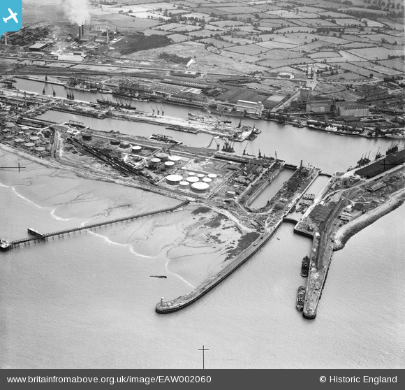
EAW002060 ENGLAND (1946). The Royal Edward Dock, Avonmouth, 1946
© Copyright OpenStreetMap contributors and licensed by the OpenStreetMap Foundation. 2026. Cartography is licensed as CC BY-SA.
Nearby Images (13)
EAW002060

EAW002059

EPW005491

EPW005503

EPW005501

EPR000059A

EPW005508

EPW005506

EAW002255

EPW005492

EAW002058

EPW005494

EPW005502

Details
| Title | [EAW002060] The Royal Edward Dock, Avonmouth, 1946 |
| Reference | EAW002060 |
| Date | 31-July-1946 |
| Link | |
| Place name | AVONMOUTH |
| Parish | |
| District | |
| Country | ENGLAND |
| Easting / Northing | 350672, 178960 |
| Longitude / Latitude | -2.7108278066951, 51.506933125199 |
| National Grid Reference | ST507790 |
Pins

redmist |
Wednesday 11th of November 2020 08:05:45 PM | |
|
redmist |
Sunday 8th of November 2020 04:11:21 PM | |
|
redmist |
Sunday 8th of November 2020 04:10:15 PM | |
|
redmist |
Sunday 8th of November 2020 04:09:17 PM | |
|
redmist |
Sunday 8th of November 2020 04:08:43 PM | |

Sparky |
Monday 18th of September 2017 09:03:46 PM | |

Class31 |
Saturday 22nd of February 2014 07:54:52 PM |