
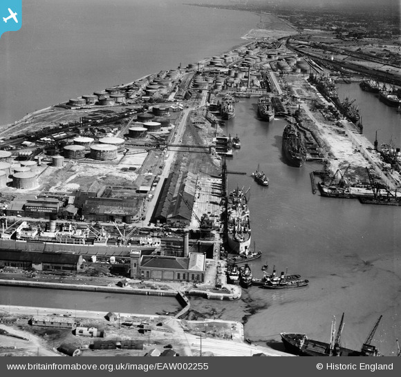
EAW002255 ENGLAND (1946). The Port of Bristol Authority Royal Edward Docks, Avonmouth, 1946
© Copyright OpenStreetMap contributors and licensed by the OpenStreetMap Foundation. 2026. Cartography is licensed as CC BY-SA.
Nearby Images (17)
EAW002255

EPR000059A

EPW005493

EPR000075

EPW005500

EPW005492

EPW005508

EAW002058

EAW002249

EPW005491

EPW005502

EPW027952

EPW037152

EPW005494

EAW002059

EAW002247

EAW002060

Details
| Title | [EAW002255] The Port of Bristol Authority Royal Edward Docks, Avonmouth, 1946 |
| Reference | EAW002255 |
| Date | 18-August-1946 |
| Link | |
| Place name | AVONMOUTH |
| Parish | |
| District | |
| Country | ENGLAND |
| Easting / Northing | 350921, 178904 |
| Longitude / Latitude | -2.7072321583578, 51.506451270766 |
| National Grid Reference | ST509789 |
Pins

redmist |
Sunday 8th of November 2020 04:41:15 PM | |
|
redmist |
Sunday 8th of November 2020 04:38:12 PM | |
|
redmist |
Sunday 8th of November 2020 04:37:39 PM | |
|
redmist |
Sunday 8th of November 2020 04:33:58 PM | |
|
redmist |
Sunday 8th of November 2020 04:33:30 PM | |
|
redmist |
Sunday 8th of November 2020 04:32:14 PM | |

Class31 |
Saturday 22nd of February 2014 07:58:21 PM |