
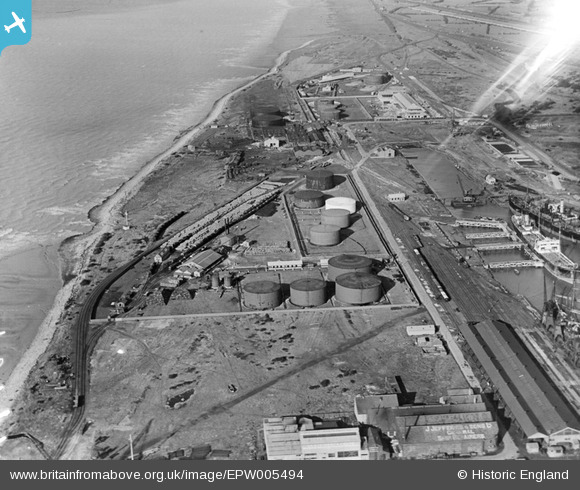
EPW005494 ENGLAND (1921). Fuel Storage Depot and the Timber Pond, Avonmouth, 1921
© Copyright OpenStreetMap contributors and licensed by the OpenStreetMap Foundation. 2026. Cartography is licensed as CC BY-SA.
Nearby Images (12)
EPW005494

EPW005497

EPW005490

EPW005496

EPW005491

EAW002249

EAW002247

EPR000059A

EAW002059

EAW002255

EPR000075

EAW002060

Details
| Title | [EPW005494] Fuel Storage Depot and the Timber Pond, Avonmouth, 1921 |
| Reference | EPW005494 |
| Date | 20-March-1921 |
| Link | |
| Place name | AVONMOUTH |
| Parish | |
| District | |
| Country | ENGLAND |
| Easting / Northing | 350909, 179125 |
| Longitude / Latitude | -2.7074358401523, 51.508437418049 |
| National Grid Reference | ST509791 |
Pins
Be the first to add a comment to this image!