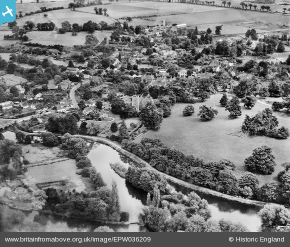
EPW036209 ENGLAND (1931). St Andrew's Church and the town centre, Sonning, 1931
© Copyright OpenStreetMap contributors and licensed by the OpenStreetMap Foundation. 2026. Cartography is licensed as CC BY-SA.
Nearby Images (11)
Details
| Title | [EPW036209] St Andrew's Church and the town centre, Sonning, 1931 |
| Reference | EPW036209 |
| Date | August-1931 |
| Link | |
| Place name | SONNING |
| Parish | SONNING |
| District | |
| Country | ENGLAND |
| Easting / Northing | 475550, 175558 |
| Longitude / Latitude | -0.91209606261378, 51.473448089269 |
| National Grid Reference | SU756756 |
Pins
Be the first to add a comment to this image!


![[EPW036209] St Andrew's Church and the town centre, Sonning, 1931](http://britainfromabove.org.uk/sites/all/libraries/aerofilms-images/public/100x100/EPW/036/EPW036209.jpg)
![[EPW036208] St Andrew's Church and the town centre, Sonning, 1931](http://britainfromabove.org.uk/sites/all/libraries/aerofilms-images/public/100x100/EPW/036/EPW036208.jpg)
![[EPW032643] St Andrew's Church and environs, Sonning, from the south-east, 1930](http://britainfromabove.org.uk/sites/all/libraries/aerofilms-images/public/100x100/EPW/032/EPW032643.jpg)
![[EPW032658] The village and the Thames Valley, Sonning, from the north-west, 1930](http://britainfromabove.org.uk/sites/all/libraries/aerofilms-images/public/100x100/EPW/032/EPW032658.jpg)
![[EPW032660] The High Street and environs, Sonning, 1930](http://britainfromabove.org.uk/sites/all/libraries/aerofilms-images/public/100x100/EPW/032/EPW032660.jpg)
![[EAW015542] Sonning Bridge and environs, Sonning Eye, 1948](http://britainfromabove.org.uk/sites/all/libraries/aerofilms-images/public/100x100/EAW/015/EAW015542.jpg)
![[EPW032520] Sonning Bridge, the River Thames and Sonning, Sonning Eye, 1930](http://britainfromabove.org.uk/sites/all/libraries/aerofilms-images/public/100x100/EPW/032/EPW032520.jpg)
![[EPW032659] The village, Sonning, from the north-west, 1930](http://britainfromabove.org.uk/sites/all/libraries/aerofilms-images/public/100x100/EPW/032/EPW032659.jpg)
![[EAW015543] Sonning Village, Sonning Bridge and environs, Sonning Eye, 1948. This image has been produced from a damaged negative.](http://britainfromabove.org.uk/sites/all/libraries/aerofilms-images/public/100x100/EAW/015/EAW015543.jpg)
![[EPW032644] Holme Park and Sonning Eye, Sonning, from the south, 1930](http://britainfromabove.org.uk/sites/all/libraries/aerofilms-images/public/100x100/EPW/032/EPW032644.jpg)
![[EPW032641] The River Thames, Sonning Bridge and the Backwater Bridges, Sonning Eye, 1930](http://britainfromabove.org.uk/sites/all/libraries/aerofilms-images/public/100x100/EPW/032/EPW032641.jpg)