
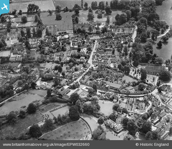
EPW032660 ENGLAND (1930). The High Street and environs, Sonning, 1930
© Copyright OpenStreetMap contributors and licensed by the OpenStreetMap Foundation. 2026. Cartography is licensed as CC BY-SA.
Nearby Images (5)
EPW032660

EPW032643

EPW036208

EPW036209

EPW032659

Details
| Title | [EPW032660] The High Street and environs, Sonning, 1930 |
| Reference | EPW032660 |
| Date | June-1930 |
| Link | |
| Place name | SONNING |
| Parish | SONNING |
| District | |
| Country | ENGLAND |
| Easting / Northing | 475723, 175553 |
| Longitude / Latitude | -0.90960645580838, 51.473380000628 |
| National Grid Reference | SU757756 |
Pins
Robert Tims |
Tuesday 10th of September 2013 12:20:28 PM |