
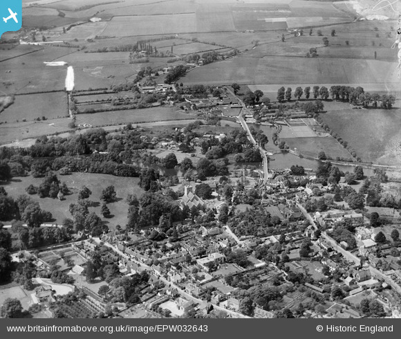
EPW032643 ENGLAND (1930). St Andrew's Church and environs, Sonning, from the south-east, 1930
© Copyright OpenStreetMap contributors and licensed by the OpenStreetMap Foundation. 2026. Cartography is licensed as CC BY-SA.
Nearby Images (6)
EPW032643

EPW032660

EPW036208

EPW036209

EPW032659

EAW015542

Details
| Title | [EPW032643] St Andrew's Church and environs, Sonning, from the south-east, 1930 |
| Reference | EPW032643 |
| Date | June-1930 |
| Link | |
| Place name | SONNING |
| Parish | SONNING |
| District | |
| Country | ENGLAND |
| Easting / Northing | 475676, 175525 |
| Longitude / Latitude | -0.91028911182834, 51.473134545061 |
| National Grid Reference | SU757755 |
Pins
Be the first to add a comment to this image!