
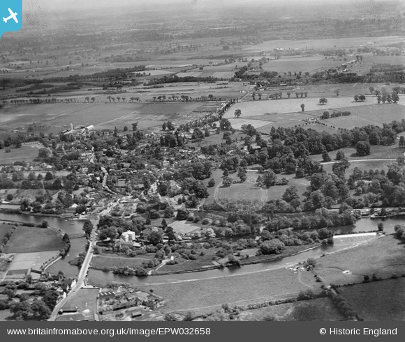
EPW032658 ENGLAND (1930). The village and the Thames Valley, Sonning, from the north-west, 1930
© Copyright OpenStreetMap contributors and licensed by the OpenStreetMap Foundation. 2026. Cartography is licensed as CC BY-SA.
Nearby Images (8)
EPW032658

EPW032520

EAW015542

EAW015543

EPW036209

EPW032641

EPW032644

EPW036208

Details
| Title | [EPW032658] The village and the Thames Valley, Sonning, from the north-west, 1930 |
| Reference | EPW032658 |
| Date | June-1930 |
| Link | |
| Place name | SONNING |
| Parish | SONNING |
| District | |
| Country | ENGLAND |
| Easting / Northing | 475393, 175616 |
| Longitude / Latitude | -0.91434401272595, 51.473990512006 |
| National Grid Reference | SU754756 |
Pins

designking |
Saturday 13th of September 2014 11:41:31 PM |