
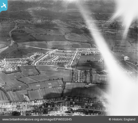
EPW031845 ENGLAND (1930). The Fairway housing estate and environs, North Wembley, 1930. This image has been affected by flare
© Copyright OpenStreetMap contributors and licensed by the OpenStreetMap Foundation. 2025. Cartography is licensed as CC BY-SA.
Nearby Images (17)
EPW031845

EPW037796

EPW031846

EPW031849

EPW037799

EPW031850

EPW031847

EPW037794

EPW031805

EPW037793

EPW037795

EPW037777

EPW031808

EPW031848

EPW044067

EPW031804

EPW031809

Details
| Title | [EPW031845] The Fairway housing estate and environs, North Wembley, 1930. This image has been affected by flare |
| Reference | EPW031845 |
| Date | 7-May-1930 |
| Link | |
| Place name | NORTH WEMBLEY |
| Parish | |
| District | |
| Country | ENGLAND |
| Easting / Northing | 517106, 186494 |
| Longitude / Latitude | -0.31029351377831, 51.564671107986 |
| National Grid Reference | TQ171865 |
Pins
Be the first to add a comment to this image!