
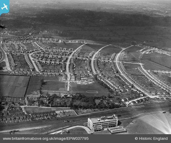
EPW037795 ENGLAND (1932). Housing estate centred upon The Fairway and the Wrigley's Chewing Gum Factory, North Wembley, 1932
© Copyright OpenStreetMap contributors and licensed by the OpenStreetMap Foundation. 2025. Cartography is licensed as CC BY-SA.
Nearby Images (11)
EPW037795

EPW037777

EPW037794

EPW044067

EPW037793

EPW031849

EPW031850

EPW031845

EPW037799

EPW037796

EPW037797

Details
| Title | [EPW037795] Housing estate centred upon The Fairway and the Wrigley's Chewing Gum Factory, North Wembley, 1932 |
| Reference | EPW037795 |
| Date | May-1932 |
| Link | |
| Place name | NORTH WEMBLEY |
| Parish | |
| District | |
| Country | ENGLAND |
| Easting / Northing | 517048, 186690 |
| Longitude / Latitude | -0.31106470731282, 51.566444896805 |
| National Grid Reference | TQ170867 |
