
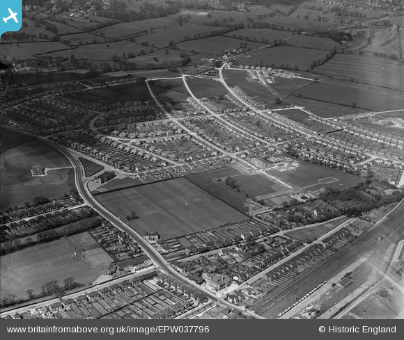
EPW037796 ENGLAND (1932). Housing estate centred upon The Fairway, North Wembley, 1932
© Copyright OpenStreetMap contributors and licensed by the OpenStreetMap Foundation. 2025. Cartography is licensed as CC BY-SA.
Nearby Images (14)
EPW037796

EPW031845

EPW031846

EPW031847

EPW031849

EPW037799

EPW031805

EPW031850

EPW037794

EPW037793

EPW031808

EPW037795

EPW037777

EPW044067

Details
| Title | [EPW037796] Housing estate centred upon The Fairway, North Wembley, 1932 |
| Reference | EPW037796 |
| Date | May-1932 |
| Link | |
| Place name | NORTH WEMBLEY |
| Parish | |
| District | |
| Country | ENGLAND |
| Easting / Northing | 517142, 186456 |
| Longitude / Latitude | -0.30978698540665, 51.564322066972 |
| National Grid Reference | TQ171865 |
Pins

The Laird |
Wednesday 16th of September 2015 03:27:46 PM | |
|
The Laird |
Wednesday 16th of September 2015 03:21:43 PM | |
|
The Laird |
Wednesday 16th of September 2015 03:18:18 PM | |
|
The Laird |
Wednesday 16th of September 2015 03:07:11 PM | |
|
The Laird |
Wednesday 16th of September 2015 03:02:12 PM | |
|
The Laird |
Wednesday 16th of September 2015 02:59:30 PM | |
|
The Laird |
Wednesday 16th of September 2015 02:57:41 PM | |
|
The Laird |
Wednesday 16th of September 2015 02:57:03 PM | |
|
The Laird |
Wednesday 16th of September 2015 02:55:55 PM |