
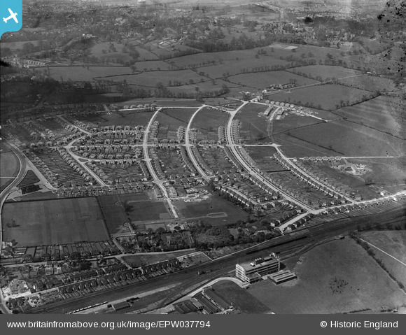
EPW037794 ENGLAND (1932). Housing estate centred upon The Fairway and the Wrigley's Chewing Gum Factory, North Wembley, 1932
© Copyright OpenStreetMap contributors and licensed by the OpenStreetMap Foundation. 2025. Cartography is licensed as CC BY-SA.
Nearby Images (13)
EPW037794

EPW037795

EPW037793

EPW037777

EPW031849

EPW044067

EPW031850

EPW031845

EPW037799

EPW037796

EPW031846

EPW037797

EPW037798

Details
| Title | [EPW037794] Housing estate centred upon The Fairway and the Wrigley's Chewing Gum Factory, North Wembley, 1932 |
| Reference | EPW037794 |
| Date | May-1932 |
| Link | |
| Place name | NORTH WEMBLEY |
| Parish | |
| District | |
| Country | ENGLAND |
| Easting / Northing | 517032, 186636 |
| Longitude / Latitude | -0.31131345619862, 51.565962839552 |
| National Grid Reference | TQ170866 |
Pins

The Laird |
Wednesday 16th of September 2015 04:12:32 PM | |
|
The Laird |
Wednesday 16th of September 2015 03:31:06 PM | |
|
The Laird |
Wednesday 16th of September 2015 03:30:38 PM | |
|
The Laird |
Wednesday 16th of September 2015 03:29:22 PM |