
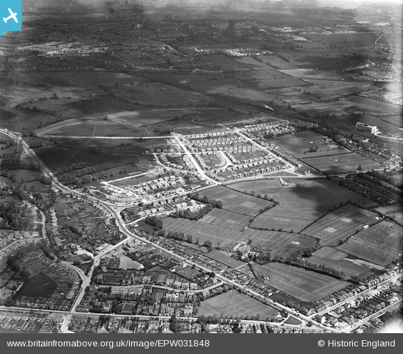
EPW031848 ENGLAND (1930). The Fairway housing estate and environs, North Wembley, 1930
© Copyright OpenStreetMap contributors and licensed by the OpenStreetMap Foundation. 2025. Cartography is licensed as CC BY-SA.
Nearby Images (15)
EPW031848

EPW031804

EPW031809

EPW031808

EPW031807

EPW031805

EPW037799

EPW037798

EPW031850

EPW037797

EPW031847

EPW031846

EPW031845

EPW031849

EPW037793

Details
| Title | [EPW031848] The Fairway housing estate and environs, North Wembley, 1930 |
| Reference | EPW031848 |
| Date | 7-May-1930 |
| Link | |
| Place name | NORTH WEMBLEY |
| Parish | |
| District | |
| Country | ENGLAND |
| Easting / Northing | 516891, 186379 |
| Longitude / Latitude | -0.31343252445371, 51.56368204394 |
| National Grid Reference | TQ169864 |
Pins

Ken |
Thursday 29th of September 2016 06:21:53 PM | |
|
Ken |
Thursday 29th of September 2016 06:21:00 PM | |
|
The Laird |
Thursday 26th of June 2014 10:38:28 PM | |
|
The Laird |
Thursday 26th of June 2014 10:30:56 PM | |

greenchief |
Wednesday 6th of November 2013 12:52:00 PM | |
|
greenchief |
Wednesday 6th of November 2013 12:51:11 PM | |
|
greenchief |
Wednesday 6th of November 2013 12:50:29 PM | |
|
greenchief |
Wednesday 6th of November 2013 12:49:36 PM |
User Comment Contributions
Viewed from the South south west |
greenchief |
Wednesday 6th of November 2013 12:56:14 PM |