
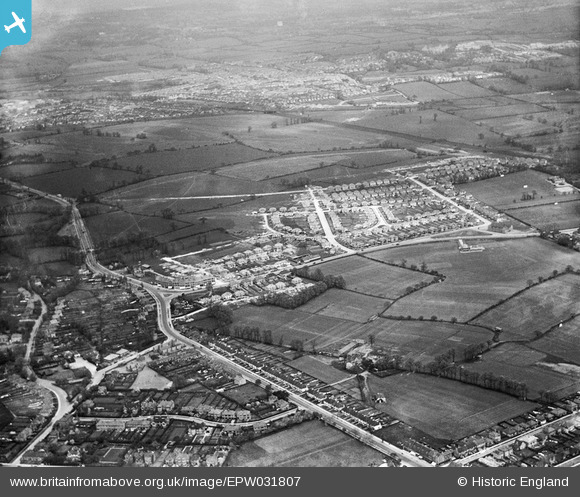
EPW031807 ENGLAND (1930). The Fairway housing estate and environs, North Wembley, 1930
© Copyright OpenStreetMap contributors and licensed by the OpenStreetMap Foundation. 2025. Cartography is licensed as CC BY-SA.
Nearby Images (12)
EPW031807

EPW031809

EPW031804

EPW031848

EPW037798

EPW031808

EPW037797

EPW031805

EPW037799

EPW031850

EPW037793

EPW031849

Details
| Title | [EPW031807] The Fairway housing estate and environs, North Wembley, 1930 |
| Reference | EPW031807 |
| Date | May-1930 |
| Link | |
| Place name | NORTH WEMBLEY |
| Parish | |
| District | |
| Country | ENGLAND |
| Easting / Northing | 516816, 186370 |
| Longitude / Latitude | -0.31451715317559, 51.563616690656 |
| National Grid Reference | TQ168864 |
Pins
 Urmi S |
Friday 8th of May 2020 08:23:25 PM | |
The Laird |
Wednesday 16th of September 2015 02:50:41 PM | |
The Laird |
Thursday 26th of June 2014 10:21:38 PM |