
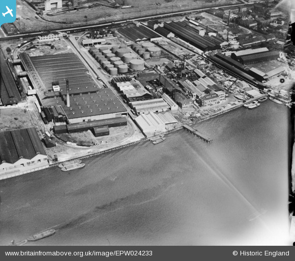
EPW024233 ENGLAND (1928). Minoco Wharf and environs, Silvertown, 1928
© Copyright OpenStreetMap contributors and licensed by the OpenStreetMap Foundation. 2026. Cartography is licensed as CC BY-SA.
Nearby Images (27)
EPW024233

EPW024230

EPW024239

EPW024232

EPW024236

EPW024231

EPW024237

EPW024241

EPW024238

EPW009698

EPW024234

EPW009696

EPW009693

EPW009695

EPW009694

EAW034526

EAW034519

EPW024235

EAW021112

EPW006144

EAW034528

EAW034521

EAW034518

EAW034520

EAW034523

EAW034525

EAW034522

Details
| Title | [EPW024233] Minoco Wharf and environs, Silvertown, 1928 |
| Reference | EPW024233 |
| Date | September-1928 |
| Link | |
| Place name | SILVERTOWN |
| Parish | |
| District | |
| Country | ENGLAND |
| Easting / Northing | 540926, 179743 |
| Longitude / Latitude | 0.030487066243933, 51.498551294938 |
| National Grid Reference | TQ409797 |
Pins

Class31 |
Thursday 19th of February 2015 10:22:55 AM |