
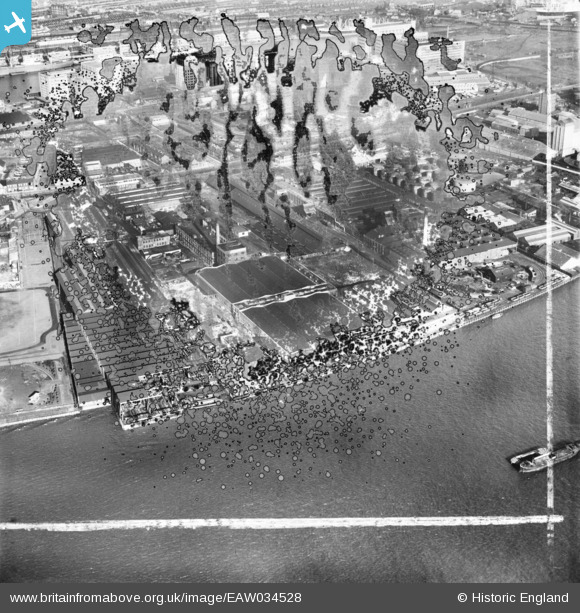
EAW034528 ENGLAND (1951). The Venesta and Crescent Wharves, Silvertown, 1951. This image has been produced from a damaged negative.
© Copyright OpenStreetMap contributors and licensed by the OpenStreetMap Foundation. 2026. Cartography is licensed as CC BY-SA.
Nearby Images (29)
EAW034528

EAW034519

EAW034526

EAW034518

EAW034523

EAW034525

EAW034521

EAW034520

EAW034522

EAW034527

EAW034524

EPW006144

EPW009699

EPW009702

EPW009701

EPW009703

EPW009700

EAW021112

EPW009704

EPW024230

EPW024233

EPW024239

EPW024232

EPW024237

EPW009695

EPW009698

EPW024236

EPW024231

EPW009694

Details
| Title | [EAW034528] The Venesta and Crescent Wharves, Silvertown, 1951. This image has been produced from a damaged negative. |
| Reference | EAW034528 |
| Date | 5-February-1951 |
| Link | |
| Place name | SILVERTOWN |
| Parish | |
| District | |
| Country | ENGLAND |
| Easting / Northing | 540731, 179769 |
| Longitude / Latitude | 0.027689737546889, 51.498833542633 |
| National Grid Reference | TQ407798 |
Pins
Be the first to add a comment to this image!