
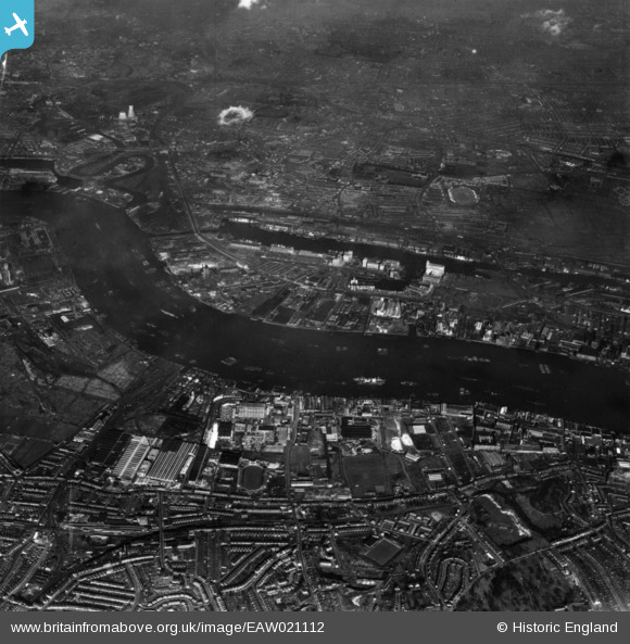
EAW021112 ENGLAND (1949). A cityscape over the River Thames and the Royal Victoria Dock, Silvertown, 1949. This image has been produced from a print.
© Copyright OpenStreetMap contributors and licensed by the OpenStreetMap Foundation. 2026. Cartography is licensed as CC BY-SA.
Nearby Images (34)
EAW021112

EPW006144

EAW034521

EAW034526

EPW009695

EAW034519

EAW034528

EPW009694

EAW034523

EAW034518

EAW034525

EPW009698

EPW024239

EPW024230

EAW034520

EPW024233

EPW009693

EPW009696

EAW034522

EAW034527

EPW009702

EPW024238

EPW009699

EPW024232

EPW009701

EPW009704

EPW024236

EPW024231

EAW034524

EPW024237

EPW009703

EPW024241

EPW009700

EPW024234

Details
| Title | [EAW021112] A cityscape over the River Thames and the Royal Victoria Dock, Silvertown, 1949. This image has been produced from a print. |
| Reference | EAW021112 |
| Date | 22-February-1949 |
| Link | |
| Place name | SILVERTOWN |
| Parish | |
| District | |
| Country | ENGLAND |
| Easting / Northing | 540804, 179892 |
| Longitude / Latitude | 0.028789929683389, 51.499920745095 |
| National Grid Reference | TQ408799 |
Pins

Class31 |
Saturday 28th of February 2015 08:45:22 AM |