
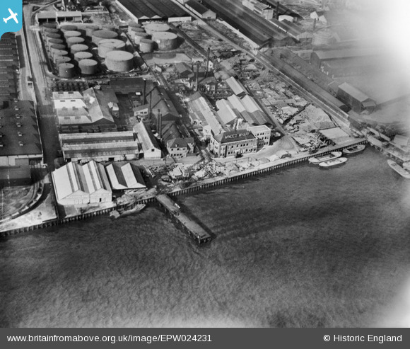
EPW024231 ENGLAND (1928). Minoco Wharf and environs, Silvertown, 1928
© Copyright OpenStreetMap contributors and licensed by the OpenStreetMap Foundation. 2026. Cartography is licensed as CC BY-SA.
Nearby Images (22)
EPW024231

EPW024236

EPW024241

EPW024232

EPW024237

EPW024234

EPW024233

EPW024230

EPW024239

EPW024238

EPW009696

EPW009693

EPW009698

EPW009694

EPW009695

EPW024235

EAW034526

EAW034519

EAW021112

EPW006144

EAW034528

EAW034521

Details
| Title | [EPW024231] Minoco Wharf and environs, Silvertown, 1928 |
| Reference | EPW024231 |
| Date | September-1928 |
| Link | |
| Place name | SILVERTOWN |
| Parish | |
| District | |
| Country | ENGLAND |
| Easting / Northing | 540974, 179725 |
| Longitude / Latitude | 0.031170998190919, 51.4983775609 |
| National Grid Reference | TQ410797 |
Pins
Be the first to add a comment to this image!