
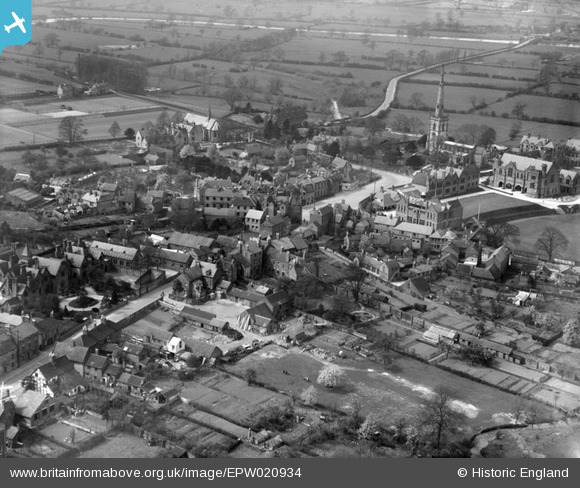
EPW020934 ENGLAND (1928). The village centre, Repton, 1928
© Copyright OpenStreetMap contributors and licensed by the OpenStreetMap Foundation. 2026. Cartography is licensed as CC BY-SA.
Nearby Images (16)
EPW020934

EPW020933

EAW013780

EPW019699

EAW013777

EPW020935

EPW019702

EAW013779

EPW019698

EAW013778

EAW013776

EPW019700

EPW020932

EPW019706

EPW019707

EPW019703

Details
| Title | [EPW020934] The village centre, Repton, 1928 |
| Reference | EPW020934 |
| Date | April-1928 |
| Link | |
| Place name | REPTON |
| Parish | REPTON |
| District | |
| Country | ENGLAND |
| Easting / Northing | 430341, 327036 |
| Longitude / Latitude | -1.549516405446, 52.83965372201 |
| National Grid Reference | SK303270 |
Pins
Be the first to add a comment to this image!